Seismiles Route


 share this post

Information
The so-called Seismiles Route is the section of the Argentinean National Route 60 from Fiambalá to the San Francisco pass and its continuation along the Chilean Route 31 to the Nevado de Tres Cruces National Park. The name Seismiles is due to the fact that it passes through one of the highest areas of the Andes Mountains, where several peaks are over 6000 metres high. Both the Argentinean road 60 and the Chilean road 31 are fully paved.Regarding the best time of the year to do this trip, bear in mind that in winter (June to September) temperatures are usually very low with snowfalls and at times the San Francisco pass can be cut off. My advice is to check the weather forecast and the state of the roads and the San Francisco pass on the gendarmerie's website before you go.
An important thing to take into account is that on this route the last fuel station on the Argentinean side is in Fiambalá and on the Chilean side it is in Copiapó, which means 480 km without refuelling.
Along the way, you will see Andean landscapes with lagunas (like lakes), thermal pools, volcanoes, etc. Several of the Seismiles can be easily observed from the road itself or by taking a road that opens up from the road.
Making the journey from Fiambalá to the Nevado de Tres Cruces National Park, you can see the following attractions in this order:
- Cañón del Indio (Indian Canyon): there you can go trekking during which you can appreciate a landscape with geological shapes. In particular, one of them has the appearance of an Indian's face, which in turn has in front of it a second geoform that also resembles a face.
- Quebrada de las Angosturas: It starts at about 37 kilometres from Fiambalá. It is a winding stretch where the Chaschuil River flows between hills with reddish tones.
- Chaschuil Valley: here the route runs parallel to the Chaschuil River, where wildlife can be observed. In this area the wind can be very strong.
- Fork to the Balcón del Pissis (Pissis Balcony): a gravel road opens up that after 54 km reaches a natural viewpoint where you can see the Mount Pissis, which is the third highest peak in the American continent. Please note that there can be very strong winds on this road and there are no services of any kind.
- Cortaderas: there is a hotel and a reservoir at 3300 metres above sea level where you can see a great number of aquatic birds. Among the species of interest are the Puna plover (Charadrius alticola), Andean coot (Fulica ardesiaca), cinnamon teal (Spatula cyanoptera), Baird's sandpiper (Calidris bairdiis) and Andean negrito (Lessonia oreas). There is a bridge over the road where the reservoir empties its waters into the Chaschuil River, which is also its tributary.
- Quebrada Ojos de las Losas: it appears as a large expanse of sand with almost no vegetation at all.
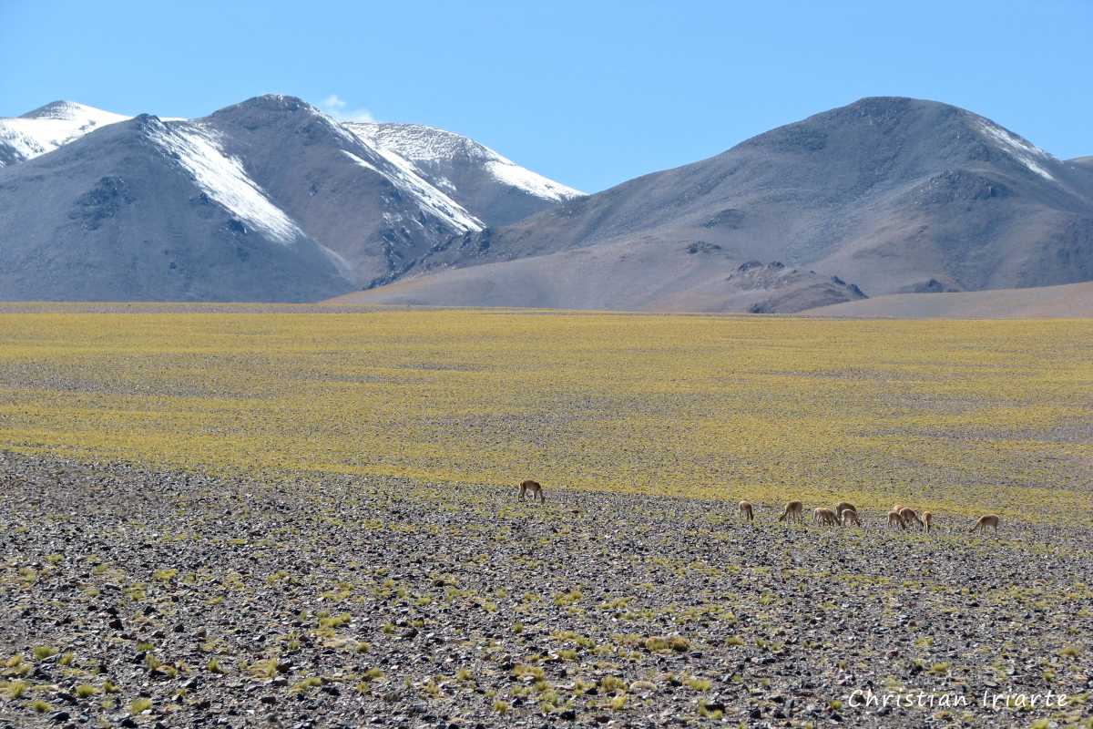
- Las Peladas: it appears as a landscape of pastures with a striking yellow colour.
- Then from the same road you start to have good views of the Incahuasi volcano (6640 metres above sea level).
- Las Grutas: it is a provincial road camp at 4000 metres above sea level where travellers can spend the night, as it has shared toilets and a dormitory. From there, if you look at the road towards the border with Chile, you will be able to see the Incahuasi volcanoes on the left and San Francisco on the right.
- Hot Springs: 400 metres from Las Grutas in the direction of Chile, there is a dirt road to the left. This path has forks, so be careful not to get lost (take a GPS with a previously loaded map). After 800 metres you will reach a stone structure with the hot spring inside. This area is almost at the foot of the Incahuasi and San Francisco volcanoes, which you can see very closely.
- Shortly before reaching the international border, if you look from the road to the left, you will have a full view of the San Francisco volcano.
- San Francisco pass: it is at 4726 metres above sea level and is the international border between Argentina and Chile.
- Laguna Verde: it is a turquoise coloured body of water above 4000 metres above sea level. From its surroundings you can clearly appreciate the El Fraile volcano (6061 metres above sea level), which is easily recognisable due to its almost perfect conical shape.
- Nevado de Tres Cruces National Park: it is a protected area with lodging and roads to visit it.



 to explore